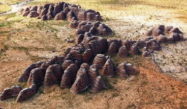
Image Source: theatlantic.com/photo-trip-bungle-bungles/
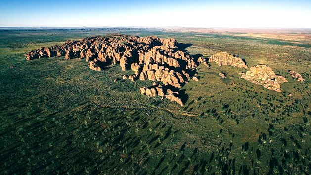
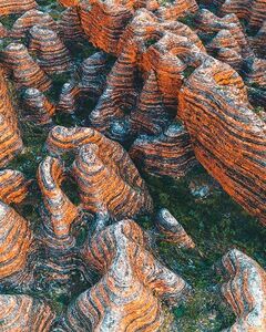
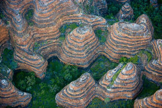
Imagine trekking through the Australian outback and suddenly coming upon landforms that appear to be giant alien beehives. Wow! And we thought we had problems with African killer bees. What creature could have built these monumental hives?
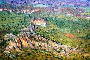
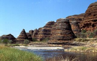
Not to worry. These are only part of the Bungle Bungle Range in Australia’s Purnululu National Park [pronounced as ‘Boornoolooloo]. The hive-looking rock formations are believed to be the result of erosion of a very ancient meteorite crater. Sediment deposited in the crater 350 to 375 million years ago has slowly eroded from wind and rain, carving out these cones and spires of porous conglomerate rock. Hence, its Aboriginal name Billingjal, which means “Sand Falling Away”.
LOCATION: Way Way Out Back
Australia is a big continent. You probably won’t run into Purnululu National Park -- also known as the Bungles National Park -- by accident.
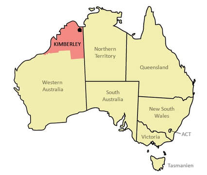
The park is located in a remote area in the East Kimberley region of Western Australia. The nearly 600,000 acre national park is located approximately 190 miles south of Kununurra, with Halls Creek located to the south. The national park is managed by the Western Australian Department of Environment and Conservation in conjunction with the traditional Aboriginal owners. The black dot in the ▼ upper left is the park location. .
File:Kimberley_region_of_western_australia.JPG and File:Regions_of_western_australia_nine_plus_perth.png., CC BY 3.0,
Image Source: commons.wikimedia.org/
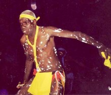
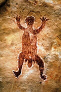
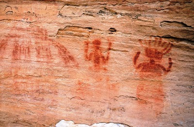
The Aboriginal Karjaganujaru people have occupied this area for 20,000 years. They continue to have a strong relationship with the land and know it well. Much of what is known about the ancient people comes from carvings and burial sites within the caverns, boasting how a civilization could exist for so long unknown to the modern world.
Image Source: aboriginal-art-australia.com/aboriginal-dreaming Image source: longhorntours.blogspot.com/archive.html
The Karjaganujaru people, sometimes miscalled the Kija, are part of a small language group of Aboriginal Australians in the East Kimberly area. Kija, also spelled Gija and Gidja, is now spoken by only a few hundred people.
Other than the Aboriginal owners of the land and some locals, the Bungle Bungle Range and its unique landforms were unknown to the rest of the world until 1982 when film-makers arrived to produce a documentary about Kimberley. The area became a National Park in 1987 and was also declared a World Heritage Site in 2003.
GENERAL DESCRIPTION
The Bungle Bungle Range is located on the plains fringing the eastern Kimberley region. Originally, the region consisted of ancient sea beds which over millions of year were covered over by layers of the mineral dolomite. The range is believed to be the eroded remnant of a former impact crater known as the Piccaninny Crater.
Image Source: NASA - Satellite imagery taken from NASA World Wind software (by screenshot)
Image Source: en.wikipedia.org/Piccaninny_crater ▼
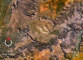
| Image Credit: ▲ Jon Connel on Flicker [creative commons] Image Source atlasobscura.com/bungle-bungle-range |
Image Source: : theatlantic.com/photo-trip-bungle-bungles
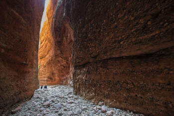
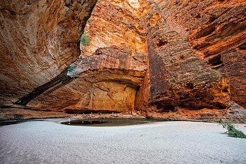
Besides the Bungles themselves there are wonderful caverns and streams to explore, although visitors are strictly controlled. There are organized tours, but most of the area is not accessible for wandering around because of the fragile nature of the environment.
| ▲Entrance of Echidna Chasm Image Credit: Philip Schubert / Shutterstock Image Source: theatlantic.com/photo-trip-bungle-bungles | Cathedral Gorge Image Credit:Philip Schubert / Shutterstock Image Source: theatlantic.com/photo-trip-bungle-bungles |
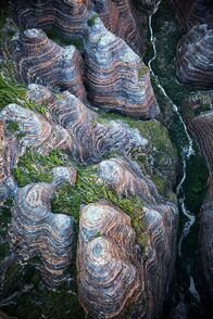
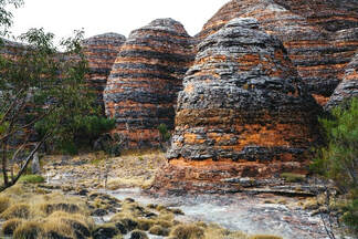
The most impressive feature of the bungles is the colored striations of material exposed as erosion and wind have carved the bee hives.
The distinct orange-and-black-ringed pattern running all down the surface of the bungles is caused not only by the conglomerate nature of their make-up but from water getting trapped in denser layers, allowing algae to grow and form the darker colorations.
Image Source: en.wikipedia.org/Bungle_Bungle_Range
This protective layer is easily displaced. Allowing tourists to scramble around the bungles unsupervised or hike off the trails would result in damage to the protective layer, speeding up the erosion.
Image Source: redbull.com/surreal-peaks
Since the lighter layers have less clay, they tend to dry quickly. Cyanobacteria grow there without the moisture, so those area lack the protective coating. Without it, the iron in the sandstone oxidizes, creating the rust colored orange striations.
Voilà, we have grey and orange stripped bee hives, another marvel of Mother Nature.
ANOTHER INTERESTING PLACE TO PUT ON YOUR BUCKET LIST.
□
Sources:
https://www.theatlantic.com/photo/2019/10/photo-trip-bungle-bungles/599794/
https://en.wikipedia.org/wiki/Bungle_Bungle_Range
http://www.worldeasyguides.com/australia/purnululu-national-park/
https://www.australiaunwrapped.com/bungle-bungle-range/
https://www.mindat.org/loc-272710.html
https://www.atlasobscura.com/places/bungle-bungle-range
https://www.kimberleyaustralia.com/bungle-bungles-ranges.html
https://www.lonelyplanet.com/maps/pacific/australia/western-australia/
https://www.aboriginal-art-australia.com/aboriginal-art-library/understanding-aboriginal-dreaming-and-the-dreamtime/
https://www.thekimberleyaustralia.com/
https://bluethumb.com.au/lyn-watts/Artwork/aerial-view-of-purnululu-bungle-bungles-east-kimberley
http://longhorntours.blogspot.com/2012_07_01_archive.html
https://www.redbull.com/int-en/10-surreal-peaks
https://www.atlasobscura.com/places/bungle-bungle-range#:~:text=These%20Australian%20rock%20formations%20look%20like%20Martian%20beehives,the%20erosion%20of%20a%20very%20ancient%20meteorite%20crater.
https://www.tripadvisor.com/Attraction_Review-g1729507-d258795-Reviews-Bungle_Bungle_Range-Purnululu_National_Park_Kimberley_Region_Western_Australia.html
https://www.bunglebungleguidedtours.com.au/about-us/purnululu-national-park-tours/#:~:text=Purnululu%20National%20Park%20Facts%20The%20Bungle%20Bungle%20Range,the%20range%20reaches%20578%20metres%20above%20sea%20level.
 RSS Feed